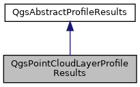
Implementation of QgsAbstractProfileResults for point cloud layers. More...
#include <qgspointcloudlayerprofilegenerator.h>

Classes | |
| struct | PointResult |
Public Member Functions | |
| QgsPointCloudLayerProfileResults () | |
| ~QgsPointCloudLayerProfileResults () override | |
| QVector< QgsGeometry > | asGeometries () const override |
| Returns a list of geometries representing the calculated elevation results. More... | |
| void | copyPropertiesFromGenerator (const QgsAbstractProfileGenerator *generator) override |
| Copies properties from specified generator to the results object. More... | |
| QMap< double, double > | distanceToHeightMap () const override |
| Returns the map of distance (chainage) to height. More... | |
| void | finalize (QgsFeedback *feedback) |
| Finalizes results – should be called after last point is added. More... | |
| QVector< QgsProfileIdentifyResults > | identify (const QgsDoubleRange &distanceRange, const QgsDoubleRange &elevationRange, const QgsProfileIdentifyContext &context) override |
| Identify results visible within the specified ranges. More... | |
| QVector< QgsProfileIdentifyResults > | identify (const QgsProfilePoint &point, const QgsProfileIdentifyContext &context) override |
| Identify results visible at the specified profile point. More... | |
| void | renderResults (QgsProfileRenderContext &context) override |
| Renders the results to the specified context. More... | |
| QgsPointSequence | sampledPoints () const override |
| Returns a list of sampled points, with their calculated elevation as the point z value. More... | |
| QgsProfileSnapResult | snapPoint (const QgsProfilePoint &point, const QgsProfileSnapContext &context) override |
| Snaps a point to the generated elevation profile. More... | |
| QString | type () const override |
| Returns the unique string identifier for the results type. More... | |
| QgsDoubleRange | zRange () const override |
| Returns the range of the retrieved elevation values. More... | |
 Public Member Functions inherited from QgsAbstractProfileResults Public Member Functions inherited from QgsAbstractProfileResults | |
| virtual | ~QgsAbstractProfileResults () |
Public Attributes | |
| double | maxZ = std::numeric_limits< double >::lowest() |
| double | minZ = std::numeric_limits< double >::max() |
| bool | opacityByDistanceEffect = false |
| QColor | pointColor |
| double | pointSize = 1 |
| QgsUnitTypes::RenderUnit | pointSizeUnit = QgsUnitTypes::RenderMillimeters |
| Qgis::PointCloudSymbol | pointSymbol = Qgis::PointCloudSymbol::Square |
| bool | respectLayerColors = true |
| std::vector< PointResult > | results |
| double | tolerance = 0 |
Friends | |
| class | QgsPointCloudLayerProfileGenerator |
Detailed Description
Implementation of QgsAbstractProfileResults for point cloud layers.
- Note
- Not available in Python bindings
- Since
- QGIS 3.26
Definition at line 57 of file qgspointcloudlayerprofilegenerator.h.
Constructor & Destructor Documentation
◆ QgsPointCloudLayerProfileResults()
| QgsPointCloudLayerProfileResults::QgsPointCloudLayerProfileResults | ( | ) |
Definition at line 38 of file qgspointcloudlayerprofilegenerator.cpp.
◆ ~QgsPointCloudLayerProfileResults()
|
override |
Definition at line 43 of file qgspointcloudlayerprofilegenerator.cpp.
Member Function Documentation
◆ asGeometries()
|
overridevirtual |
Returns a list of geometries representing the calculated elevation results.
Implements QgsAbstractProfileResults.
Definition at line 105 of file qgspointcloudlayerprofilegenerator.cpp.
◆ copyPropertiesFromGenerator()
|
overridevirtual |
Copies properties from specified generator to the results object.
For instance, this method can be used to copy any properties relating to rendering the gathered results to reflect the generator's current properties.
The base class method does nothing.
Reimplemented from QgsAbstractProfileResults.
Definition at line 278 of file qgspointcloudlayerprofilegenerator.cpp.
◆ distanceToHeightMap()
|
overridevirtual |
Returns the map of distance (chainage) to height.
Implements QgsAbstractProfileResults.
Definition at line 82 of file qgspointcloudlayerprofilegenerator.cpp.
◆ finalize()
| void QgsPointCloudLayerProfileResults::finalize | ( | QgsFeedback * | feedback | ) |
Finalizes results – should be called after last point is added.
Definition at line 49 of file qgspointcloudlayerprofilegenerator.cpp.
◆ identify() [1/2]
|
overridevirtual |
Identify results visible within the specified ranges.
Reimplemented from QgsAbstractProfileResults.
Definition at line 246 of file qgspointcloudlayerprofilegenerator.cpp.
◆ identify() [2/2]
|
overridevirtual |
Identify results visible at the specified profile point.
Reimplemented from QgsAbstractProfileResults.
Definition at line 240 of file qgspointcloudlayerprofilegenerator.cpp.
◆ renderResults()
|
overridevirtual |
Renders the results to the specified context.
Implements QgsAbstractProfileResults.
Definition at line 122 of file qgspointcloudlayerprofilegenerator.cpp.
◆ sampledPoints()
|
overridevirtual |
Returns a list of sampled points, with their calculated elevation as the point z value.
Implements QgsAbstractProfileResults.
Definition at line 93 of file qgspointcloudlayerprofilegenerator.cpp.
◆ snapPoint()
|
overridevirtual |
Snaps a point to the generated elevation profile.
Reimplemented from QgsAbstractProfileResults.
Definition at line 191 of file qgspointcloudlayerprofilegenerator.cpp.
◆ type()
|
overridevirtual |
Returns the unique string identifier for the results type.
Implements QgsAbstractProfileResults.
Definition at line 77 of file qgspointcloudlayerprofilegenerator.cpp.
◆ zRange()
|
overridevirtual |
Returns the range of the retrieved elevation values.
Implements QgsAbstractProfileResults.
Definition at line 117 of file qgspointcloudlayerprofilegenerator.cpp.
Friends And Related Function Documentation
◆ QgsPointCloudLayerProfileGenerator
|
friend |
Definition at line 120 of file qgspointcloudlayerprofilegenerator.h.
Member Data Documentation
◆ maxZ
| double QgsPointCloudLayerProfileResults::maxZ = std::numeric_limits< double >::lowest() |
Definition at line 84 of file qgspointcloudlayerprofilegenerator.h.
◆ minZ
| double QgsPointCloudLayerProfileResults::minZ = std::numeric_limits< double >::max() |
Definition at line 83 of file qgspointcloudlayerprofilegenerator.h.
◆ opacityByDistanceEffect
| bool QgsPointCloudLayerProfileResults::opacityByDistanceEffect = false |
Definition at line 91 of file qgspointcloudlayerprofilegenerator.h.
◆ pointColor
| QColor QgsPointCloudLayerProfileResults::pointColor |
Definition at line 90 of file qgspointcloudlayerprofilegenerator.h.
◆ pointSize
| double QgsPointCloudLayerProfileResults::pointSize = 1 |
Definition at line 86 of file qgspointcloudlayerprofilegenerator.h.
◆ pointSizeUnit
| QgsUnitTypes::RenderUnit QgsPointCloudLayerProfileResults::pointSizeUnit = QgsUnitTypes::RenderMillimeters |
Definition at line 87 of file qgspointcloudlayerprofilegenerator.h.
◆ pointSymbol
| Qgis::PointCloudSymbol QgsPointCloudLayerProfileResults::pointSymbol = Qgis::PointCloudSymbol::Square |
Definition at line 88 of file qgspointcloudlayerprofilegenerator.h.
◆ respectLayerColors
| bool QgsPointCloudLayerProfileResults::respectLayerColors = true |
Definition at line 89 of file qgspointcloudlayerprofilegenerator.h.
◆ results
| std::vector< PointResult > QgsPointCloudLayerProfileResults::results |
Definition at line 80 of file qgspointcloudlayerprofilegenerator.h.
◆ tolerance
| double QgsPointCloudLayerProfileResults::tolerance = 0 |
Definition at line 81 of file qgspointcloudlayerprofilegenerator.h.
The documentation for this class was generated from the following files:
- /build/qgis-3.26.3+32focal/src/core/pointcloud/qgspointcloudlayerprofilegenerator.h
- /build/qgis-3.26.3+32focal/src/core/pointcloud/qgspointcloudlayerprofilegenerator.cpp
 1.8.17