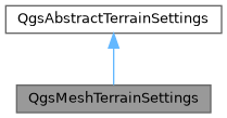
Terrain settings for a terrain generator that uses the Z values of a mesh layer to build a terrain. More...
#include <qgsmeshterrainsettings.h>
Public Member Functions | |
| QgsMeshTerrainSettings () | |
| ~QgsMeshTerrainSettings () override | |
| QgsMeshTerrainSettings * | clone () const final |
| Returns a copy of the terrain settings. | |
| std::unique_ptr< QgsTerrainGenerator > | createTerrainGenerator (const Qgs3DRenderContext &context) const override |
| Creates a new instance of a terrain generator which matches the terrain settings. | |
| bool | equals (const QgsAbstractTerrainSettings *other) const final |
Returns true if this settings is exactly equal to another other settings. | |
| QgsMeshLayer * | layer () const |
| Returns the mesh layer with elevation model to be used for terrain generation. | |
| void | readXml (const QDomElement &element, const QgsReadWriteContext &context) final |
| Reads settings from a DOM element. | |
| void | resolveReferences (const QgsProject *project) final |
| After reading settings from XML, resolves references to any layers in a project that have been read as layer IDs. | |
| void | setLayer (QgsMeshLayer *layer) |
| Sets the mesh layer with elevation model to be used for terrain generation. | |
| void | setSymbol (QgsMesh3DSymbol *symbol) |
| Sets the symbol used to render the mesh as terrain. | |
| QgsMesh3DSymbol * | symbol () const |
| Returns the symbol used to render the mesh as terrain. | |
| QString | type () const final |
| Returns the unique type name for the terrain generator. | |
| void | writeXml (QDomElement &element, const QgsReadWriteContext &context) const final |
| Writes settings to a DOM element. | |
| Public Member Functions inherited from QgsAbstractTerrainSettings | |
| virtual | ~QgsAbstractTerrainSettings () |
| double | elevationOffset () const |
| Returns the elevation offset of the terrain (used to move the terrain up or down). | |
| int | mapTileResolution () const |
| Returns the resolution (in pixels) of the texture of a terrain tile. | |
| double | maximumGroundError () const |
| Returns the maximum ground error of terrain tiles in world units. | |
| double | maximumScreenError () const |
| Returns the maximum allowed screen error of terrain tiles in pixels. | |
| void | setElevationOffset (double offset) |
| Sets the terrain elevation offset (used to move the terrain up or down). | |
| void | setMapTileResolution (int resolution) |
| Sets the resolution (in pixels) of the texture of a terrain tile. | |
| void | setMaximumGroundError (double error) |
| Sets the maximum ground error of terrain tiles in world units. | |
| void | setMaximumScreenError (double error) |
| Sets the maximum allowed screen error of terrain tiles in pixels. | |
| void | setVerticalScale (double scale) |
| Sets the vertical scale (exaggeration) for terrain. | |
| double | verticalScale () const |
| Returns the vertical scale (exaggeration) for terrain. | |
Static Public Member Functions | |
| static QgsAbstractTerrainSettings * | create () |
| Creates a new instance of a QgsMeshTerrainSettings object. | |
Additional Inherited Members | |
| Protected Member Functions inherited from QgsAbstractTerrainSettings | |
| void | copyCommonProperties (const QgsAbstractTerrainSettings *source) |
| Copies common properties from a source object. | |
| bool | equalsCommon (const QgsAbstractTerrainSettings *other) const |
Returns true if common base class settings from other match this object. | |
| void | readCommonProperties (const QDomElement &element, const QgsReadWriteContext &context) |
| Reads common properties from the base class from the given DOM element. | |
| void | writeCommonProperties (QDomElement &element, const QgsReadWriteContext &context) const |
| Writes common properties from the base class into an XML element. | |
Detailed Description
Terrain settings for a terrain generator that uses the Z values of a mesh layer to build a terrain.
- Warning
- This is not considered stable API, and may change in future QGIS releases. It is exposed to the Python bindings as a tech preview only.
- Since
- QGIS 3.42
Definition at line 39 of file qgsmeshterrainsettings.h.
Constructor & Destructor Documentation
◆ QgsMeshTerrainSettings()
| QgsMeshTerrainSettings::QgsMeshTerrainSettings | ( | ) |
Definition at line 31 of file qgsmeshterrainsettings.cpp.
◆ ~QgsMeshTerrainSettings()
|
overridedefault |
Member Function Documentation
◆ clone()
|
finalvirtual |
Returns a copy of the terrain settings.
Implements QgsAbstractTerrainSettings.
Definition at line 37 of file qgsmeshterrainsettings.cpp.
◆ create()
|
static |
Creates a new instance of a QgsMeshTerrainSettings object.
Definition at line 26 of file qgsmeshterrainsettings.cpp.
◆ createTerrainGenerator()
|
overridevirtual |
Creates a new instance of a terrain generator which matches the terrain settings.
- Note
- Not available in Python bindings
Implements QgsAbstractTerrainSettings.
Definition at line 102 of file qgsmeshterrainsettings.cpp.
◆ equals()
|
finalvirtual |
Returns true if this settings is exactly equal to another other settings.
Implements QgsAbstractTerrainSettings.
Definition at line 87 of file qgsmeshterrainsettings.cpp.
◆ layer()
| QgsMeshLayer * QgsMeshTerrainSettings::layer | ( | ) | const |
Returns the mesh layer with elevation model to be used for terrain generation.
- See also
- setLayer()
Definition at line 119 of file qgsmeshterrainsettings.cpp.
◆ readXml()
|
finalvirtual |
Reads settings from a DOM element.
Subclasses should take care to call readCommonProperties() to read common properties from the element.
- See also
- resolveReferences()
- writeXml()
Implements QgsAbstractTerrainSettings.
Definition at line 51 of file qgsmeshterrainsettings.cpp.
◆ resolveReferences()
|
finalvirtual |
After reading settings from XML, resolves references to any layers in a project that have been read as layer IDs.
- See also
- readXml()
Reimplemented from QgsAbstractTerrainSettings.
Definition at line 82 of file qgsmeshterrainsettings.cpp.
◆ setLayer()
| void QgsMeshTerrainSettings::setLayer | ( | QgsMeshLayer * | layer | ) |
Sets the mesh layer with elevation model to be used for terrain generation.
- See also
- layer()
Definition at line 114 of file qgsmeshterrainsettings.cpp.
◆ setSymbol()
| void QgsMeshTerrainSettings::setSymbol | ( | QgsMesh3DSymbol * | symbol | ) |
Sets the symbol used to render the mesh as terrain.
- See also
- symbol()
Definition at line 129 of file qgsmeshterrainsettings.cpp.
◆ symbol()
| QgsMesh3DSymbol * QgsMeshTerrainSettings::symbol | ( | ) | const |
Returns the symbol used to render the mesh as terrain.
- See also
- setSymbol()
Definition at line 124 of file qgsmeshterrainsettings.cpp.
◆ type()
|
finalvirtual |
Returns the unique type name for the terrain generator.
Implements QgsAbstractTerrainSettings.
Definition at line 46 of file qgsmeshterrainsettings.cpp.
◆ writeXml()
|
finalvirtual |
Writes settings to a DOM element.
Subclasses should take care to call writeCommonProperties() to write common properties to the element.
- See also
- readXml()
Implements QgsAbstractTerrainSettings.
Definition at line 69 of file qgsmeshterrainsettings.cpp.
The documentation for this class was generated from the following files:
- /build/qgis-4.3.0+git20260721+9ff14a2eeba+99sid/src/3d/terrain/qgsmeshterrainsettings.h
- /build/qgis-4.3.0+git20260721+9ff14a2eeba+99sid/src/3d/terrain/qgsmeshterrainsettings.cpp
Generated on for QGIS API Documentation by