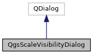
A dialog allowing users to enter a scale visibility range. More...
#include <qgsscalevisibilitydialog.h>

Public Slots | |
| void | setMaximumScale (double scale) |
| Set the maximum scale, or 0 to indicate the minimum is not set. More... | |
| void | setMinimumScale (double scale) |
| Set the minimum scale, or 0 to indicate the minimum is not set. More... | |
| void | setScaleVisiblity (bool hasScaleVisibility) |
| Set whether scale based visibility is enabled. More... | |
Public Member Functions | |
| QgsScaleVisibilityDialog (QWidget *parent=nullptr, const QString &title=QString(), QgsMapCanvas *mapCanvas=nullptr) | |
| Constructor for QgsScaleVisibilityDialog, with specified dialog title. More... | |
| bool | hasScaleVisibility () const |
| Returns true if scale based visibilty is enabled. More... | |
| double | maximumScale () const |
| Returns the selected maximum scale, or 0 if maximum scale is not set. More... | |
| double | minimumScale () const |
| Returns the selected minimum scale, or 0 if minimum scale is not set. More... | |
Properties | |
| bool | hasScaleVisibility |
| double | maximumScale |
| double | minimumScale |
Detailed Description
A dialog allowing users to enter a scale visibility range.
Definition at line 32 of file qgsscalevisibilitydialog.h.
Constructor & Destructor Documentation
◆ QgsScaleVisibilityDialog()
|
explicit |
Constructor for QgsScaleVisibilityDialog, with specified dialog title.
The mapCanvas argument can be used to associate the dialog with a map canvas, allowing use of the current map scale within the dialog.
Definition at line 24 of file qgsscalevisibilitydialog.cpp.
Member Function Documentation
◆ hasScaleVisibility()
| bool QgsScaleVisibilityDialog::hasScaleVisibility | ( | ) | const |
Returns true if scale based visibilty is enabled.
◆ maximumScale()
| double QgsScaleVisibilityDialog::maximumScale | ( | ) | const |
Returns the selected maximum scale, or 0 if maximum scale is not set.
The scale value indicates the scale denominator, e.g. 1000.0 for a 1:1000 map.
- See also
- minimumScale()
- setMaximumScale())
◆ minimumScale()
| double QgsScaleVisibilityDialog::minimumScale | ( | ) | const |
Returns the selected minimum scale, or 0 if minimum scale is not set.
The scale value indicates the scale denominator, e.g. 1000.0 for a 1:1000 map.
- See also
- maximumScale()
- setMinimumScale()
◆ setMaximumScale
|
slot |
Set the maximum scale, or 0 to indicate the minimum is not set.
The scale value indicates the scale denominator, e.g. 1000.0 for a 1:1000 map.
- See also
- maximumScale()
- setMinimumScale()
Definition at line 77 of file qgsscalevisibilitydialog.cpp.
◆ setMinimumScale
|
slot |
Set the minimum scale, or 0 to indicate the minimum is not set.
The scale value indicates the scale denominator, e.g. 1000.0 for a 1:1000 map.
- See also
- minimumScale()
- setMaximumScale()
Definition at line 67 of file qgsscalevisibilitydialog.cpp.
◆ setScaleVisiblity
|
slot |
Set whether scale based visibility is enabled.
- See also
- hasScaleVisibility()
Definition at line 57 of file qgsscalevisibilitydialog.cpp.
Property Documentation
◆ hasScaleVisibility
|
readwrite |
Definition at line 35 of file qgsscalevisibilitydialog.h.
◆ maximumScale
|
readwrite |
Definition at line 37 of file qgsscalevisibilitydialog.h.
◆ minimumScale
|
readwrite |
Definition at line 36 of file qgsscalevisibilitydialog.h.
The documentation for this class was generated from the following files:
- /tmp/buildd/qgis-3.6.0+99unstable/src/gui/qgsscalevisibilitydialog.h
- /tmp/buildd/qgis-3.6.0+99unstable/src/gui/qgsscalevisibilitydialog.cpp
 1.8.13