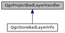
Interface for classes that handle missing layer files when reading project file. More...
#include <qgsprojectbadlayerhandler.h>

Public Member Functions | |
| virtual | ~QgsProjectBadLayerHandler ()=default |
| virtual void | handleBadLayers (const QList< QDomNode > &layers) |
| This method will be called whenever the project tries to load layers which cannot be accessed. More... | |
Protected Types | |
| enum | DataType { IS_VECTOR, IS_RASTER, IS_BOGUS } |
| file data representation More... | |
| enum | ProviderType { IS_FILE, IS_DATABASE, IS_URL, IS_Unknown } |
| the flavors for data storage More... | |
Protected Member Functions | |
| QString | dataSource (const QDomNode &layerNode) |
| Returns the data source for the given layer. More... | |
| DataType | dataType (const QDomNode &layerNode) |
| Returns data type associated with the given QgsProject file Dom node. More... | |
| ProviderType | providerType (const QDomNode &layerNode) |
| Returns the physical storage type associated with the given layer. More... | |
| void | setDataSource (QDomNode &layerNode, const QString &dataSource) |
| Set the datasource element to the new value. More... | |
Detailed Description
Interface for classes that handle missing layer files when reading project file.
Definition at line 27 of file qgsprojectbadlayerhandler.h.
Member Enumeration Documentation
◆ DataType
|
protected |
file data representation
| Enumerator | |
|---|---|
| IS_VECTOR | Vector data. |
| IS_RASTER | Raster data. |
| IS_BOGUS | Bogus data. |
Definition at line 49 of file qgsprojectbadlayerhandler.h.
◆ ProviderType
|
protected |
the flavors for data storage
| Enumerator | |
|---|---|
| IS_FILE | Saved in a file. |
| IS_DATABASE | Saved in a database. |
| IS_URL | Retrieved from a URL. |
| IS_Unknown | Unknown type. |
Definition at line 57 of file qgsprojectbadlayerhandler.h.
Constructor & Destructor Documentation
◆ ~QgsProjectBadLayerHandler()
|
virtualdefault |
Member Function Documentation
◆ dataSource()
|
protected |
Returns the data source for the given layer.
The QDomNode is a QgsProject Dom node corresponding to a map layer state.
Essentially dumps datasource tag.
- Since
- QGIS 3.0
Definition at line 61 of file qgsprojectbadlayerhandler.cpp.
◆ dataType()
|
protected |
Returns data type associated with the given QgsProject file Dom node.
The Dom node should represent the state associated with a specific layer.
- Since
- QGIS 3.0
Definition at line 32 of file qgsprojectbadlayerhandler.cpp.
◆ handleBadLayers()
|
virtual |
This method will be called whenever the project tries to load layers which cannot be accessed.
It should inform the user about this and if possible offer to fix the unavailable layers by setting a valid datasource, e.g. by showing a file dialog.
The default implementation will dismiss all bad layers and write information to the log.
- Since
- QGIS 3.0
Reimplemented in QgsStoreBadLayerInfo.
Definition at line 23 of file qgsprojectbadlayerhandler.cpp.
◆ providerType()
|
protected |
Returns the physical storage type associated with the given layer.
The QDomNode is a QgsProject Dom node corresponding to a map layer state.
If the provider tag is "ogr", then it's a file type.
However, if the layer is a raster, then there won't be a provider tag. It will always have an associated file.
If the layer doesn't fall into either of the previous two categories, then it's either a database or URL. If the datasource tag has "url=", then it's URL based and if it has "dbname=">, then the layer data is in a database.
- Since
- QGIS 3.0
Definition at line 75 of file qgsprojectbadlayerhandler.cpp.
◆ setDataSource()
|
protected |
Set the datasource element to the new value.
- Since
- QGIS 3.0
Definition at line 112 of file qgsprojectbadlayerhandler.cpp.
The documentation for this class was generated from the following files:
- /tmp/buildd/qgis-3.6.0+99unstable/src/core/qgsprojectbadlayerhandler.h
- /tmp/buildd/qgis-3.6.0+99unstable/src/core/qgsprojectbadlayerhandler.cpp
 1.8.13