Provides some enum describing the environment currently supported for configuration. More...
#include <qgsserversettings.h>
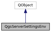
Inheritance diagram for QgsServerSettingsEnv:

Public Types | |
| enum | EnvVar { QGIS_OPTIONS_PATH, QGIS_SERVER_PARALLEL_RENDERING, QGIS_SERVER_MAX_THREADS, QGIS_SERVER_LOG_LEVEL, QGIS_SERVER_LOG_FILE, QGIS_SERVER_LOG_STDERR, QGIS_PROJECT_FILE, MAX_CACHE_LAYERS, QGIS_SERVER_CACHE_DIRECTORY, QGIS_SERVER_CACHE_SIZE, QGIS_SERVER_SHOW_GROUP_SEPARATOR, QGIS_SERVER_OVERRIDE_SYSTEM_LOCALE, QGIS_SERVER_WMS_MAX_HEIGHT, QGIS_SERVER_WMS_MAX_WIDTH, QGIS_SERVER_API_RESOURCES_DIRECTORY, QGIS_SERVER_API_WFS3_MAX_LIMIT } |
| Environment variables to configure the server. More... | |
| enum | Source { DEFAULT_VALUE, ENVIRONMENT_VARIABLE, INI_FILE } |
| Source of the parameter used in the configuration. More... | |
Detailed Description
Provides some enum describing the environment currently supported for configuration.
- Since
- QGIS 3.0
Definition at line 37 of file qgsserversettings.h.
Member Enumeration Documentation
◆ EnvVar
Environment variables to configure the server.
Definition at line 52 of file qgsserversettings.h.
◆ Source
Source of the parameter used in the configuration.
| Enumerator | |
|---|---|
| DEFAULT_VALUE | |
| ENVIRONMENT_VARIABLE | |
| INI_FILE | |
Definition at line 43 of file qgsserversettings.h.
The documentation for this class was generated from the following file:
- /build/qgis-3.10.0+15buster/src/server/qgsserversettings.h
 1.8.13