|
QGIS API Documentation
2.4.0-Chugiak
|


All Classes Namespaces Files Functions Variables Typedefs Enumerations Enumerator Properties Friends Macros Groups Pages
|
QGIS API Documentation
2.4.0-Chugiak
|
This class provides details of the viewable area that a raster will be rendered into. More...
#include <qgsrasterviewport.h>
Public Attributes | |
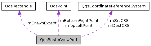
| QgsPoint | mTopLeftPoint |
| Coordinate (in output device coordinate system) of top left corner of the part of the raster that is to be rendered. More... | |
| QgsPoint | mBottomRightPoint |
| Coordinate (in output device coordinate system) of bottom right corner of the part of the raster that is to be rendered. More... | |
| int | mWidth |
| Width, number of columns to be rendered. More... | |
| int | mHeight |
| Distance in map units from bottom edge to top edge for the part of the raster that is to be rendered. More... | |
| QgsRectangle | mDrawnExtent |
| Intersection of current map extent and layer extent. More... | |
| QgsCoordinateReferenceSystem | mSrcCRS |
| Source coordinate system. More... | |
| QgsCoordinateReferenceSystem | mDestCRS |
| Target coordinate system. More... | |
| int | mSrcDatumTransform |
| int | mDestDatumTransform |
This class provides details of the viewable area that a raster will be rendered into.
The qgsrasterviewport class sets up a viewport / area of interest to be used by rasterlayer draw functions at the point of drawing to the screen.
Definition at line 31 of file qgsrasterviewport.h.
| QgsPoint QgsRasterViewPort::mBottomRightPoint |
Coordinate (in output device coordinate system) of bottom right corner of the part of the raster that is to be rendered.
Definition at line 38 of file qgsrasterviewport.h.
Referenced by QgsRasterLayer::previewAsImage(), and QgsRasterLayer::previewAsPixmap().
| QgsCoordinateReferenceSystem QgsRasterViewPort::mDestCRS |
Target coordinate system.
Definition at line 54 of file qgsrasterviewport.h.
Referenced by QgsRasterLayer::draw(), QgsRasterLayer::previewAsImage(), QgsRasterLayer::previewAsPixmap(), and QgsRasterLayerRenderer::render().
| int QgsRasterViewPort::mDestDatumTransform |
Definition at line 57 of file qgsrasterviewport.h.
Referenced by QgsRasterLayer::draw(), QgsRasterLayer::previewAsImage(), and QgsRasterLayer::previewAsPixmap().
| QgsRectangle QgsRasterViewPort::mDrawnExtent |
Intersection of current map extent and layer extent.
Definition at line 48 of file qgsrasterviewport.h.
Referenced by QgsRasterDrawer::draw(), QgsRasterLayer::previewAsImage(), and QgsRasterLayer::previewAsPixmap().
| int QgsRasterViewPort::mHeight |
Distance in map units from bottom edge to top edge for the part of the raster that is to be rendered.
Height, number of rows to be rendered
Definition at line 45 of file qgsrasterviewport.h.
Referenced by QgsRasterDrawer::draw(), QgsRasterLayer::init(), QgsRasterLayer::previewAsImage(), and QgsRasterLayer::previewAsPixmap().
| QgsCoordinateReferenceSystem QgsRasterViewPort::mSrcCRS |
Source coordinate system.
Definition at line 51 of file qgsrasterviewport.h.
Referenced by QgsRasterLayer::draw(), QgsRasterLayer::previewAsImage(), QgsRasterLayer::previewAsPixmap(), and QgsRasterLayerRenderer::render().
| int QgsRasterViewPort::mSrcDatumTransform |
Definition at line 56 of file qgsrasterviewport.h.
Referenced by QgsRasterLayer::draw(), QgsRasterLayer::previewAsImage(), and QgsRasterLayer::previewAsPixmap().
| QgsPoint QgsRasterViewPort::mTopLeftPoint |
Coordinate (in output device coordinate system) of top left corner of the part of the raster that is to be rendered.
Definition at line 35 of file qgsrasterviewport.h.
Referenced by QgsRasterDrawer::drawImage(), QgsRasterLayer::previewAsImage(), and QgsRasterLayer::previewAsPixmap().
| int QgsRasterViewPort::mWidth |
Width, number of columns to be rendered.
Definition at line 41 of file qgsrasterviewport.h.
Referenced by QgsRasterDrawer::draw(), QgsRasterLayer::init(), QgsRasterLayer::previewAsImage(), and QgsRasterLayer::previewAsPixmap().
 1.8.7
1.8.7