|
QGIS API Documentation
2.2.0-Valmiera
|
|
QGIS API Documentation
2.2.0-Valmiera
|
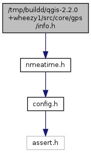
#include "nmeatime.h"

Go to the source code of this file.
Classes | |
| struct | _nmeaPOS |
| Position data in fractional degrees or radians. More... | |
| struct | _nmeaSATELLITE |
| Information about satellite. More... | |
| struct | _nmeaSATINFO |
| Information about all satellites in view. More... | |
| struct | _nmeaINFO |
| Summary GPS information from all parsed packets, used also for generating NMEA stream. More... | |
Macros | |
| #define | NMEA_SIG_BAD (0) |
| #define | NMEA_SIG_LOW (1) |
| #define | NMEA_SIG_MID (2) |
| #define | NMEA_SIG_HIGH (3) |
| #define | NMEA_FIX_BAD (1) |
| #define | NMEA_FIX_2D (2) |
| #define | NMEA_FIX_3D (3) |
| #define | NMEA_MAXSAT (12) |
| #define | NMEA_SATINPACK (4) |
| #define | NMEA_NSATPACKS (NMEA_MAXSAT / NMEA_SATINPACK) |
| #define | NMEA_DEF_LAT (5001.2621) |
| #define | NMEA_DEF_LON (3613.0595) |
Typedefs | |
| typedef struct _nmeaPOS | nmeaPOS |
| Position data in fractional degrees or radians. | |
| typedef struct _nmeaSATELLITE | nmeaSATELLITE |
| Information about satellite. | |
| typedef struct _nmeaSATINFO | nmeaSATINFO |
| Information about all satellites in view. | |
| typedef struct _nmeaINFO | nmeaINFO |
| Summary GPS information from all parsed packets, used also for generating NMEA stream. | |
Functions | |
| void | nmea_zero_INFO (nmeaINFO *info) |
Definition in file info.h.
| #define NMEA_MAXSAT (12) |
Definition at line 43 of file info.h.
Referenced by QgsNMEAConnection::processGSASentence().
| #define NMEA_NSATPACKS (NMEA_MAXSAT / NMEA_SATINPACK) |
| #define NMEA_SATINPACK (4) |
Definition at line 44 of file info.h.
Referenced by QgsNMEAConnection::processGSVSentence().
Summary GPS information from all parsed packets, used also for generating NMEA stream.
| typedef struct _nmeaSATELLITE nmeaSATELLITE |
Information about satellite.
| typedef struct _nmeaSATINFO nmeaSATINFO |
| void nmea_zero_INFO | ( | nmeaINFO * | info | ) |
 1.8.1.2